A mountain-dotted route through south-western Victoria reveals more than 400 sleeping volcanoes.
Story By Don Fuchs
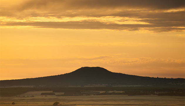
The view from the top of Victoria’s Mt Rouse is breathtaking. To the north, the jagged skyline of the Grampians ends the flat expanse of an enormous plain. To the south, the flats end at the Southern Ocean, about 60 kilometres away. To the west, a solitary mountain focuses the view, and to the east the plains fade into the late evening haze.
For those without a geological background the panorama is simply stunning. For those in the know, however, it is a revelation. What you see is one of world’s largest basalt plains. The lone mountain is Mt Napier, the most recently active volcano in Victoria. The distant hills to the east are also born of fire. And so is Mt Rouse itself. The stony rises on the country below were once lava flows.
Mt Rouse lies within what geologists call the Newer Volcanic Province. The area covers more than 19,000 square kilometres, stretching from Melbourne to Mt Burr, north-west of Mount Gambier in South Australia. Within this volcanic field are a staggering 437 known volcanoes. Julie Boyce, a researcher from Monash University’s School of Geosciences, recently identified 23 ‘new’ volcanoes in the region. “The more you look at these things, the more you realise that volcanoes have a very distinctive morphology,” Julie says. Once you know what to look for, you start seeing volcanoes everywhere.
This Story is from Issue #101
Outback Magazine: June/July 2015