Attempting to beat a path along the Northern Territory/Queensland border from the desert to the sea gives modern-day adventurers renewed respect for the surveyors who first blazed the route.
Story By Ron and Viv Moon
Standing on the crest of a raw red dune, we strain our eyes to catch a glimpse – any glimpse, no matter how small – of a marker to indicate the present-day border of the Northern Territory and Queensland. We are about 113 kilometres north of Poeppel Corner, where the South Australian, Territory and Queensland borders meet up with each other in the sea of sand that is the Simpson Desert.
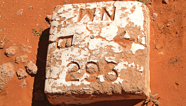
More than 120 years ago, when Augustus Poeppel carried out his survey of the SA/Qld border and the NT/Qld border, he had supposedly marked it with a post or peg every mile and a major post every 10 miles. For the more significant corner post, he dragged a two-metre length of a coolibah tree by camel from the Mulligan River flats, some 100km to the east.
This story excerpt is from Issue #48
Outback Magazine: Aug/Sep 2006