Driving the Barrier Highway between Gawler and Broken Hill provides a fascinating tour through South Australia’s rich mining and Merino heritage.
Story and photos Denis O'Byrne
In 1885, the quickest way to travel from Adelaide to the new mines around Silverton and Broken Hill – both just across the border in New South Wales – was to take the train to Terowie, SA, then transfer to a stagecoach for the final 300 kilometres of the journey. Today, the wheel ruts have long since been covered over by a broad strip of bitumen that forms part of the Barrier Highway between Adelaide and Sydney.
Our journey begins near Gawler, 43km north of Adelaide, where the Sturt and Barrier highways part company. From here it’s 510km to Broken Hill. While the drive is by no means a marathon – it can easily be done in a day – there are sufficient highlights en route to stretch it to four or five days.
A major feature of the trip is the 14 mostly tiny townships that are scattered along the highway, the largest of which is Burra, once a copper mining boom town. The remainder either sprang up beside the waters that sustained early drovers and teamsters, or grew around locomotive watering and coaling points on the new railways. For a while they flourished, only to decline as farm populations shrank, motorised transport displaced draught animals and railway jobs disappeared. The lack of major development since their busy times has ensured the survival of many 19th century structures and streetscapes that otherwise would probably have been lost.
With the exception of Olary, SA, each community has at least one historic pub still operating. These are stone-walled, mostly single-storeyed structures and are often the most substantial buildings in town, usually built in the mid to late 1800s. Each has plenty of character and, when combined with a warm welcome, results in a memorable pub crawl through part of South Australia’s rich heritage.
Leaving the Sturt Highway, travellers soon pass Roseworthy with its huge bank of silos. Wheat, barley, canola and legumes and, to a lesser extent, wool, sheep meat and beef are mainstays of the economy from here to Manoora, while wheat and sheep dominate on the drier country northwards to Terowie. Founded in the 1880s, the Roseworthy Agricultural College was the first agricultural education centre in Australia, and it’s still operating. Research at the college led to the discovery of the value of phosphorus in Australian soils.
A few minutes later, the road to Freeling turns off on the right. Fans of the television drama McLeod’s Daughters will want to make a pilgrimage to the Gungellan Hotel. Along with the streets of Freeling, this venerable structure is a regular feature on the show. The McLeods’ station (real name “Kingsford”) is owned by Channel Nine and, sadly, is off-limits to the public.
Heading north, there are four small, attractive townships – Tarlee, Riverton, Saddleworth and Manoora – all of which owe their beginnings to the Burra copper mines. In the 1850s, at the height of the mining boom, an army of 1200 teamsters and 8000 bullocks were hauling ore from Burra to Port Adelaide and back-loading supplies. Wayside inns like the Riverton Hotel (established 1855) sprang up and, in some cases, villages grew around them.
Riverton (population 800) is the largest of the four. Established in 1856, it has interesting structures dating from its first 20 years of settlement. It is within commuting distance of Adelaide and is central to prosperous Gawler and the rich Barossa and Clare valleys, so a significant proportion of the workforce lives here but works elsewhere. Recently, it has been the only town along the highway to show growth. An estate of 42 house blocks has recently been released and council has approved two more. “These developments are the shot in the arm that Riverton needed,” says Karen Slape, a resident of 10 years. “We have an ageing population and an influx of younger people will guarantee the town’s viability.”
Set in a valley among barren hills, Burra (population 1200) is one of Australia’s most important historic towns. Copper was discovered here in 1845 and, within six years, more than 1000 men were employed in what had become Australia’s largest metalliferous mine. By 1850 Burra had become Australia’s largest inland town with a population of 5000. Copper production waned after 1860 and had ceased altogether by 1877, leaving the mines and town to lie largely undisturbed. Subsequently, Burra boasts an impressive collection of heritage sites and attracts around 100,000 visitors annually.
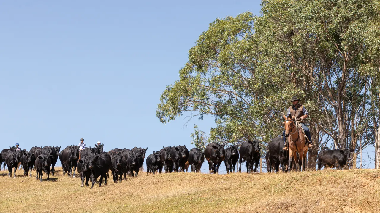
Settlers with sheep arrived here in the early 1840s – two shepherds discovered the original copper lodes – and sheep have made an enormous contribution to the economy since, with many Merino studs throughout the district. While not as strong, wool remains an important contributor. “Local breeders have developed a type that produces a softer handling fleece on a larger frame,” says Will Nolan of Burra’s Landmark office. “Merinos from this district have been bred to tolerate a wide range of climatic conditions, giving them a relatively high survival rate under varied extreme conditions.”
The three communities in the 63km between Burra and Terowie were once all bustling railway towns, and each has a notable pub. Mount Bryan (population 70) has a classic pub known for its gourmet menu; Hallett has the Wildongoleeche Hotel, which has a stuffed dingo and photographs of champion Merino rams at the bar; and Whyte Yarcowie (population 26) has the Yarcowie Hotel. Yarcowie’s hosts Steve and Maureen Richards, both expat Kiwis, moved up from Adelaide in 2005 for a change of lifestyle. “It’s so quiet and peaceful, and the people are so friendly,” Maureen says. “We’re loving it.” She estimates that about one-third of the population is employed at least some of the time, while the remainder are pensioners. “Affordable housing is a big attraction,” she says.
Terowie (see Issue 45) was established in the 1870s and took off when it became the railhead for the broad gauge line from Adelaide, with bullock teams camping here waiting to be loaded with freight for Silverton and Broken Hill. When the narrow gauge line arrived from Quorn, Terowie became a break-of-gauge point where goods and passengers were transferred between trains. At its peak in the 1940s, Terowie’s population was more than 2000, but it received knockout punches in the 1960s when the broad gauge line was extended to Peterborough and the Barrier Highway was re-routed to bypass the town. Although the population has dropped to around 200, Terowie has been saved from dereliction largely through the efforts of the Terowie Citizens Association, which has refurbished a number of buildings in its historic main street.
The highway beyond Terowie links small communities that were associated with the narrow gauge railway, which was built in the late 1880s to haul ore from Broken Hill to the Port Pirie Smelter. It was replaced 80 years later by a standard gauge line that requires much less maintenance. Part of the east-west transcontinental link, the new line largely follows the highway between Broken Hill and Terowie, where it heads west for Port Pirie. The loss of railway jobs and the sealing of the highway in the 1960s and 1970s sounded the death knell for these little settlements. Today, they are largely in a moribund condition, with derelict buildings a reminder of busier times.
Some 34km past Terowie is tiny Oodla Wirra, which consists of a pub (the Halfway Hotel), a roadhouse and a fruit-fly checkpoint. The latter forms part of the quarantine effort to keep Queensland fruit-fly and other exotic plant pests out of South Australia’s Riverland, where their introduction would devastate the fruit and vegetable growing industry. “Despite the warning signs, we collect 40 to 50 kilos of banned plant material each day,” says inspector Chris Smith, dropping a bag of confiscated fruit into a bin. “It’s by no means unusual to find pieces of fruit infested by maggots.”
Past Oodla Wirra, the highway swings north-eastwards into saltbush country, where 245-square-kilometre East Whydown Station is located. Owned and managed by Joan and Chris Macdonald, the property was established by Joan’s great-grandfather in 1882 as part of a much larger run. “East Whydown is quite small by local standards,” Joan says. “We’ve been in drought for the past decade and that’s reduced our flock size to around 4000 Merino ewes.”
Joan and Chris diversified into tourism five years ago to help pay the cost of educating their two sons. “It’s been great fun and I wish we’d bitten the bullet earlier,” Joan says. Their visitors’ book indicates that their guests enjoy the experience just as much.
Back on the main road, it’s 18km to Yunta, population 50. Set on a lightly timbered plain with rugged hills and ridges scattered all around, Yunta has been a service centre for local properties and highway traffic, but the continuing decline in station populations is hitting hard. The big concern is that the 10-pupil school will close, triggering another exodus of residents. “In my day, the maximum population has been 150, but over the last five years it has dropped from 85 to 50,” says Gary Fuller, the fourth generation of his family to own nearby Wabricoola Station. A board member of the Outback Areas Community Development Trust and a former president (for 17 years) of the Yunta Progress Association (YPA), Gary takes a keen interest in the wellbeing of his hometown. “I’m doing all I can to ensure that Yunta gets the services and infrastructure it needs for people to stay.”
Yunta has previously received a grant for an emergency road rescue unit and recently received one for a rural transaction centre. Grants are funded on a dollar-for-dollar basis, so the YPA spends a lot of time organising fundraising activities. “Yunta is volunteer rich, but cash poor,“ Gary says. “We were only able to hold up our end of these projects because of the willingness of local residents to provide voluntary labour and discounted materials.”
The country is scenic north of Yunta, with Winnininnie Creek a stunning highlight. The highway then enters a vast, shrub-covered plain that stretches all the way to the Thackaringa Hills, just inside New South Wales. The almost ghost towns of Mannahill and Olary slip by in the blink of an eye before reaching Cockburn (population 23), a scatter of buildings on a low rise that gives a view of distant hills floating on the mirage. Cockburn was once sufficiently busy to support two pubs – the Coburn Hotel (established in the 1880s) is still in business, while the Bordergate has been converted into a truck stop. Had it not been for inter-colonial bloody-mindedness, Cockburn (then Coburn) would have been just another siding on the original Broken Hill to Port Pirie line. When the South Australian Government was building the line in the late 1880s, it asked the New South Wales Government for permission to continue across the border to complete the final 50km link to Broken Hill. This was refused, so the privately-owned Silverton Tramway Company constructed this section. For 80 years locomotives and their crews changed at the border, and travellers can still see the turntable that was used to turn the engines around.Cockburn’s importance diminished when the Commonwealth built the present line in 1968.
From Cockburn, the end of the journey is 50km away. Soon, travellers pass the first of the mine headframes that now stand silent witness to the end of an era. Broken Hill, an iconic outback town and birthplace of one of the world’s richest mining companies, awaits.
This story excerpt is from Issue #52
Outback Magazine: Apr/May 2007