An off-the-beaten track loops through a lesser-known part of New England, one of New South Wales’ premier agricultural regions.
Story + Photos Don Fuchs
The busy B78, also known as the Waterfall Way, heads from Armidale through farmland east towards the coast. Its name promises thundering cataracts, drifting spray, dramatic geographical landmarks: Dangar Falls, Wollomombi Falls, Chandler Falls. Yet all are currently reduced to a trickle, with only Ebor Falls, which sources its water not from the drought-affected New England Tableland, but from its eastern edge, still flowing. Here, where the tablelands dissolve into a rugged maze of valleys and ridges, where forests rule supreme, the moist ocean air, pushed up by south-easterly winds, condenses and offloads its precious cargo.
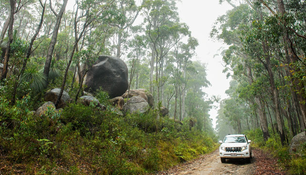
This wild region is strung with national parks. To the north of the Waterfall Way, Cathedral Rock and Guy Fawkes River national parks, as well as the World Heritage-listed Mt Hyland Nature Reserve – an often cloud-covered rainforest island in a sea of state forest – protect stunning landscapes with ecosystems full of rare plants and animals.
The challenging walk to the top of the giant granite boulders of Cathedral Rock, a loop through the often mist-covered Mt Hyland Nature Reserve or the 13-kilometre Escarpment Walk past Chaelundi Falls and the dramatic rock formation of Lucifer’s Thumb in Guy Fawkes River National Park are just some of the highlights in these reserves.
This story excerpt is from Issue #125
Outback Magazine: June/July 2019